

IAP-26-036
Advancing AI-guided geomorphic change detection in braided rivers
Gravel bed rivers are highly dynamic systems that can undergo significant geomorphic change over short periods of time. Our understanding of geomorphic change in gravel bed rivers has advanced due to the technological development of remote sensing methods (e.g. satellite imagery, unmanned aerial vehicles (UAV)), which have enabled repeat surveys and subsequent analysis of geomorphic change of river reaches (e.g. Williams et al. 2011, Wheaton et al. 2013; Boothroyd et al.2025; Aman and Dwarakish, 2026).
Sediment characteristics, such as grain-size distribution, play a critical role in shaping barform morphology and evolution (e.g. Rice and Church, 2010). Despite their importance, only a few studies have linked reach-scale geomorphic change to sediment dynamics. Field collection of sedimentary data, including lithology and grain size on the ground, is time-consuming and subject to several limitations. These include the difficulty of capturing the high spatial variability in sediment characteristics across bar surfaces and the catchment as whole, collecting representative grain size distributions across an area that capture spatial variability, as well as access and safety constraints and considerations in deep, fast-flowing river systems. It is imperative that we have a rich sediment dataset as various aspects of grain size distributions (e.g. D50, D85, D90) feed into and form the basis of sediment transport models and morphodynamic models that are of relevance to river management and risk analysis. It is also imperative that finer grain fractions (e.g. fine sands to muds) are also captured and their presence quantified. However, advances in AI-based methods now enable grain-size distributions to be derived from image-based datasets, such as photographs, facilitating repeated surveys and the analysis of sediment patterns across large areas and over time, addressing prior limitations. In addition, image-based classification methods can quantify the proportion of different grain size classes of an area based on texture and input parameters (e.g. differentiation sand, gravel, and mud fractions). However, these methodologies need to be appropriately tested and scrutinized for specific locations before they are widely applied (e.g., Vázquez-Tarrío and Recking, 2025, Mair et al. 2026).
This aims of this project are twofold
1) Examine grain-size distributions across gravel-bed river reaches over multiple time periods to determine how sediment dynamics are linked to geomorphic change at the catchment scale
2) Test the applicability and reliability of AI-based automated detection and generation of grain size distributions by validating model outputs against in-situ field measurements.
By achieving these aims this project addresses a critical knowledge gap and advances the understanding of geomorphic change in highly mobile river systems, with implications for river management, including river restoration, flood-risk assessment, enhancement of ecological habitats within and adjacent to river channels. There is scope to understand how grain size and broader geomorphic change correlate in other geographic settings (e.g. New Zealand). In addition, the results of this study will help feed into the feasibility of using citizen science derived image (photograph) datasets as a method in which to collect large scale and temporally variable grain size data (e.g. Towers et al. 2026).
Click on an image to expand
Methodology
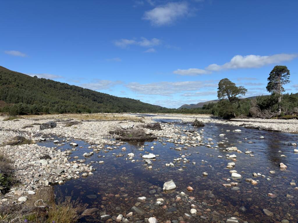
A UAV photogrammetry based dataset acquired by the University of Glasgow over the last decade a longer legacy of analysing geomorphic change (e.g. Wheaton et al., 2013) makes Glen Feshie, Scotland, an ideal candidate location to undertake this project.
It will use traditional field-based sediment sampling to characterise grain-size distributions at two time intervals. UAV photogrammetric data will be collected alongside manually derived datasets. AI-based methods, including PebbleCountsAuto (Purinton and Bookhagen, 2019), pyDGS (Buscombe, 2013), ImageGrain 2.0 (Mair et al. 2026), will then be applied to and further developed based on the new and existing digital datasets. Model outputs will then be evaluated against the field measurements. The findings will subsequently inform a broader spatial and temporal analysis of historical UAV imagery.
Project Timeline
Year 1
Literature review, field survey 1 (manual and UAV data collection). Writing data chapter/paper 1.
Year 2
AI analysis and comparison with manual measurements from field season 1. Field survey 2 (manual and UAV data collection) and analysis. Collation of historical photogrammetry datasets and geomorphic change. National based conference attendance.
Year 3
Data chapter/paper 2 (spatial variation in grain size distributions) and 3 (temporal variation in grain size distributions). International conference.
Year 3.5
Thesis/paper writing and completion.
Training
& Skills
Field sedimentology
AI-guided automated detection of grain size distribution and analysis
Topographic survey and model generation
Wider professional and scientific skills (e.g. BSG Windsor workshop)
References & further reading
Aman, A. L. and Dwarakish, G. S. (2026) ‘Geomorphic adjustment and reach-scale sensitivity of the highly braided Kosi River: A dynamic systems approach to resilience-based management’, Geomorphology, 503, https://doi.org/j.geomorph.2026.110283
Boothroyd, R.J., Williams, R.D., Hoey, T.B. et al. Big data show idiosyncratic patterns and rates of geomorphic river mobility. Nat Commun 16, 3263 (2025). https://doi.org/10.1038/s41467-025-58427-9
Buscombe, D. (2013). Transferable wavelet method for grain‐size distribution from images
of sediment surfaces and thin sections, and other natural granular
patterns. Sedimentology, 60(7), 1709-1732.
Mair, D., Witz, G., Do Prado, A., Garefalakis, P., Wild, A., Ville, F., Schuster, B., Horn, M., Österle, J., Fabbri, S. C., Litty, C., Achleitner, S., Leistner, S., Hiller, C., and Schlunegger, F.: ImageGrains 2.0: Improved precision and generalization for grain segmentation, Earth Surf. Dynam., 14, 527–551, https://doi.org/10.5194/esurf-14-527-2026, 2026.
Purinton, B., & Bookhagen, B. (2019). Introducing PebbleCounts: a grain-sizing tool for photo
surveys of dynamic gravel-bed rivers. Earth Surface Dynamics, 7(3), 859-877.
Rice, S.P. and Church, M. (2010), Grain-size sorting within river bars in relation to downstream fining along a wandering channel. Sedimentology, 57: 232-251. https://doi.org/10.1111/j.1365-3091.2009.01108.x
Towers, A. H., Attal, M., Mudd, S. M., & Clubb, F. J. (2026). Investigating controls on fluvial
grain sizes in post-glacial landscapes using citizen science. Earth Surface Dynamics, 14(1),
95-113.
Wheaton, J., J. Brasington, S. E. Darby, A. Kasprak, D. Sear, and D. Vericat (2013), Morphodynamic signatures of braiding mechanisms as expressed through change in sediment storage in a gravel-bed river, J. Geophys. Res. Earth Surf., 118, 759–779, doi:10.1002/jgrf.20060.
Williams, R., J. Brasington, D. Vericat, M. Hicks, F. Labrosse, and M. Neal (2011), Chapter Twenty—Monitoring Braided River Change Using Terrestrial Laser Scanning and Optical Bathymetric Mapping, in Developments in Earth Surface Processes, edited by P. P. Mike, J. Smith, and S. G. James, pp. 507–532, Elsevier, Amsterdam, doi:10.1016/b978-0-444-53446-0.00020-3
Vázquez-Tarrío, D. and Recking, A., 2025. The variability of grain size metrics in gravel-bed rivers. Catena, 255, p.108974
