IAP-25-046
Seascape ecology of the Antarctic Peninsula
The underwater “seascape” is made up of many different possible habitats, including biogenic habitats such as seaweed, coral, beds of molluscs or sponges, to gravel, sand, and mud. We know that animals tend to be associated with particular seabed types, but much less about how the abundance, growth and success of animals is affected by the mixture of seabed types within a seascape.
Antarctica is particularly interesting place to investigate these questions, as the effect of ice scour on the seabed has such powerful effects on benthic communities. Boundaries between communites can be sharply defined where recent ice scour has cut through the previous assemblage, or due to topographical features like gullies which protect the seabed from direct impacts. There is also the more gradual change in scour frequency with depth which creates a unique gradient in benthic diversity and complexity with depth, leading to the poorly understood Antarctic mesophotic zone.
This project will use seabed video from the area around Rothera Station, and along the Antarctic Peninsula and elsewhere obtained as part of “vessel of opportunity” citizen science studies.
Additional existing video data for the west of Scotland, and other locations will be used in comparison to Antarctic data, in a comparative study of the role of seascape structure in biodiversity and animal behaviour.
Click on an image to expand
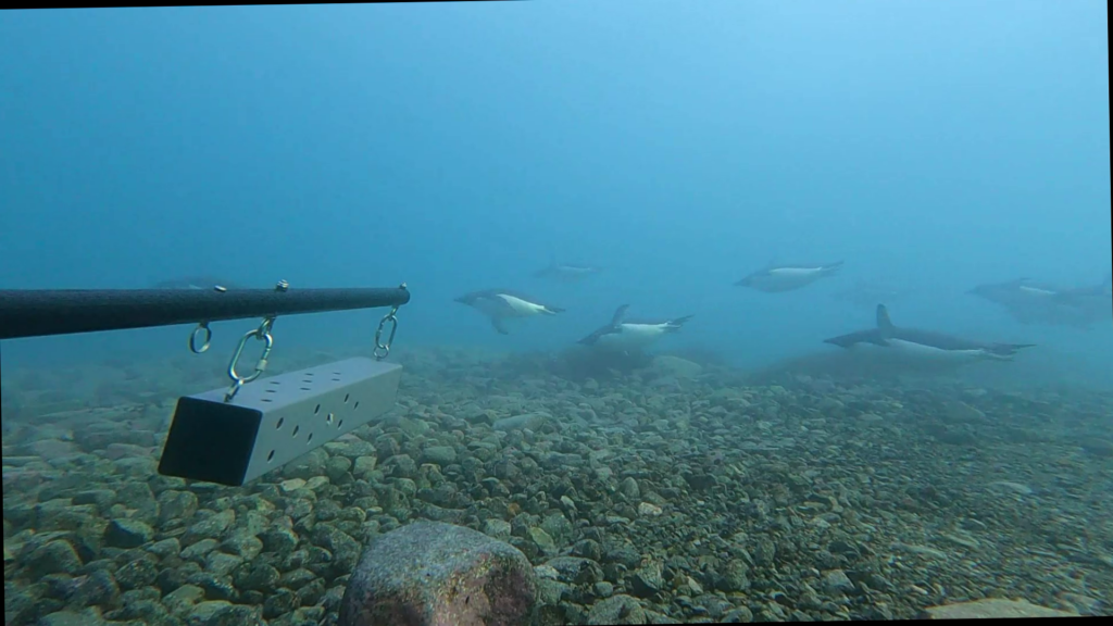
Image Captions
image credit: Simon Morley
Methodology
The project will use a mixture of new and existing underwater photography, combined with species and habitat distribution models.
Scotland
There are extensive photographic datasets for several areas, in particular stereo-baited remote underwater video (BRUV) data for the South Arran Marine Protected Area, Loch Eriboll, and the Wester Ross Marine Protected Area. New BRUV surveys are planned for these and other sites, to which the student will contribute – focusing on boundaries between disturbed and undisturbed seabed. Other georeferenced seabed and fish data will be obtained from Marine Scotland Science, Nature Scot and NGO partners. Combined with data on fishing and other disturbances/protections such as MPAs, this will allow natural and disturbed habitats to be investigated.
Antarctica
The waters around Rothera station have been extensively surveyed by divers and through the use of remotely operated vehicles and other underwater cameras. In particular the IBIS (Iceberg impact study) project has focused on iceberg scour effects on the benthos, and a previous PhD using baited cameras investigated the effects of scour on scavenging fish and invertebrates. ROV surveys have explored the area around Rothera station to a depth of 100 m, providing a large amount of available data.
Data from existing baited camera surveys around Rothera will be used, possibly supplemented with new camera drops subject to the workload of the scientific team at Rothera, but these are not essential to the project. Between BAS and vessel of opportunity sampling around 200 hours of underwater video are already available.
To provide context the Rothera Time Series (RaTS) includes 25 years of measurement of oceanographic parameters (temperature, salinity, fluorescence, PAR etc.)
Project Timeline
Year 1
Literature review
Statistics training
Analysis existing data
Field surveys, Scotland, other vessels of opportunity
Year 2
Paper writing
Field surveys, Scotland, other vessels of opportunity
Year 3
Writing
Conferences
Year 3.5
Finalising thesis
Training
& Skills
Practical skills in field work, cameras, navigation and small boats
Survival skills training appropriate for the fieldwork
Spatial analysis and distribution modelling
Scientific communication and outreach
References & further reading
N.L. Walker-Milne, S.A.M. Elliott, P.J. Wright, D.M. Bailey (2025). Seascape ecology of juvenile gadoid nursery areas. Royal Society Open Science 12 (9), 250705
N.L. Walker-Milne, S.A.M. Elliott, P.J. Wright, D.M. Bailey (2025). A novel use of Stereo Baited Remote Underwater Video and Drop-Down Video for biodiversity and marine landscape mapping and prediction. PLOS One, 20(4), e0319355.
N.M. Burns, D.M. Bailey, C.R. Hopkins (2024) Predictive GAM seabed maps can account for defined and fuzzy boundaries to improve accuracy in a Scottish sea loch seascape. Estuarine, Coastal and Shelf Science 309, 108939
S.A.M. Elliott, A.D. Sabatino, M.R. Heath, W.R. Turrell, D.M. Bailey (2017). Landscape effects on demersal fish revealed by field observations and predictive seabed modelling. PLoS ONE 12(12): e0189011
S.A.M. Elliott, W.R. Turrell, M.R. Heath, D.M. Bailey (2017). Juvenile gadoid habitat and ontogenetic shift observations using stereo-video baited cameras. Marine Ecology Progress Series 568, 123-135
K.M. Dunlop, D.K.A. Barnes and D.M. Bailey (2014). Variation of scavenger richness and abundance between sites of high and low iceberg scour frequency in Ryder Bay, West Antarctic Peninsula. Polar Biology. (37) 1741-1754
Robinson, B.J.O., Barnes, D.K.A., Grange, L.J.; Morley, S.A. (2021). Intermediate ice scour disturbance is key to maintaining a peak in biodiversity within the shallows of the Western Antarctic Peninsula. Sci Rep 11, 16712. https://doi.org/10.1038/s41598-021-96269-9
Barnes, D.K.A., Souster, T. (2011) Reduced survival of Antarctic benthos linked to climate-induced iceberg scouring. Nature Climate Change 1, 365-368