IAP-25-055
Rockfall detection and modelling in the rapidly deglaciating Mont Blanc massif
The ‘Alpine playground’ of the Mont Blanc massif is rapidly deglaciating as climate warms. One consequence is more frequent rockfalls and landslides, often in the summer months, and in the warmest parts of the day. These rockfalls pose a significant hazard to mountaineers, hikers, and built infrastructure. As an example, the Goûter Route to climb Mt Blanc was temporarily closed in 2022 due to extreme rockfall risk. These rockfalls are a ‘paraglacial’ response to ice thinning and retreat, which in theory will peak, and then subside as the landscape adjusts to non-glacial conditions. This paraglacial period is one of extreme sediment fluxes to decaying glaciers and glacier margins/forefields, which may dominate glacial sediment supply and even alter glacial dynamics. Putting numbers on the rockfall/landslide supply in a rapidly deglaciating region is challenging, but, essential to characterise evolving risks, and, to document erosion rates and slope-glacier feedbacks. The Mont Blanc / Monte Bianco region has a long record of exploration and documentation of change, and offers accessibility via cable car to high elevations around multiple glaciers – a unique combination.
Click on an image to expand
Image Captions
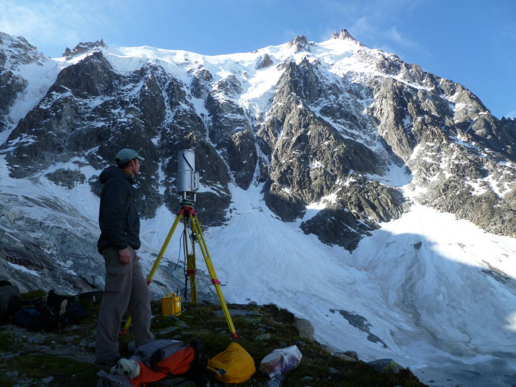
Terrestrial scanning of the north face of the Aiguille du Midi, cable car station in view at the top (3842m).
Methodology
The project relies on time-series remote sensing: long-range (4km) terrestrial laser scanning; drone Structure-from-Motion and time-lapse gigapixel imaging installs to quantify the timing and scale of change of glaciers and slopes. These 3D data can be then used to parameterise models of triggering and runout, to begin to understand the temporal and spatial patterns of activity and drivers of failure.
Project Timeline
Year 1
Collate a spatial-temporal inventory of glacier and slope change for the Mont Blanc massif from published data and collaborator datasets (including archives of Miage Glacier laser scanning data), held in a shared GIS. Gain experience in terrestrial laser scanning and drone data collection and analyses, and, work on a novel ‘gigapixel’ panoramic time-lapse camera system.
Undertake 2 data collection trips to the Mont Blanc massif (April-May; September-October).
Year 2
Process 3D and 2D data to quantify glacier and slope change and derive erosion rates and a high-resolution spatial-temporal inventory of change for selected sites. Begin to parameterise a 3D rockfall runout model using data, and/or, model drivers of failure.
Undertake 2 data collection trips to the Mont Blanc massif (April-May; September-October).
Year 3
Update the 3D and 2D analyses to derive multi-annual magnitude-frequency relationships. Complete runout modelling and couple to glacier transport and/or risk to mountain users and infrastructure. Ensemble model/test assumptions of future rockfall supply and risk.
Undertake end-user outreach and training in the Alps to ensure longevity of monitoring.
Year 3.5
Complete thesis and create an end-user open-source GIS and data portal for the inventory and modelling outputs. Write an end-user focussed document on risks posed to the different stakeholders.
Training
& Skills
You would gain skills in: 3D data collection and processing; time-lapse camera deformation/detection coding; drone flying and data processing; dGPS surveys and data processing; 4D rockfall modelling; 2D and 3D slope stability modelling (optional).
References & further reading
Please contact stuart.dunning@ncl.ac.uk for reading links