IAP-25-042
Pleistocene to present-day sea level puzzles in Patagonia: disentangling the sea-level budget to improve regional ice history.
The history of sea-level change around Patagonia (South America) remains largely unresolved due to limited observational records and complex inter-connected processes including tectonics, ocean currents, and deglacial history. The Patagonian Ice Sheet has contributed over one metre to sea-level rise since the last glacial maximum, 21,000 years ago (Davies et al. 2020), whilst over the last few decades, glaciers in this region have contributed more to sea-level rise than Antarctica (Zemp et al., 2019). These changes in ice mass strongly affect local sea-level change around Patagonia so that sea-level models have yet to successfully close past and contemporary sea-level budgets (when the sum of modelled components equals the total observed sea-level change).
Among those components affecting local sea level in southern South America, glacial isostatic adjustment (GIA) remains uncertain (Bartholet et al. 2020). GIA is the ongoing deformational response of the Earth to past and present changes in the ice sheets. Thus understanding the past and present GIA response to Patagonian ice mass changes is both scientifically valuable and societally important because sea-level budgets and projections rely on its accurate reconstruction.
The aim of the project is to disentangle the local and global drivers of sea-level change around the southern portion of South America from 35,000 years ago to present, with a specific focus on the role of GIA, and its implications for sea-level budgets and projections. The project will require a synthesis of paleo-sea-level observations into a self-consistent database (e.g., Rubio-Sandoval et al. 2025), along with contemporary measurements from tide gauges, satellite altimetry, and GPS. Models of GIA will then be run to determine sea-level change from the last glacial maximum to present day. Adjustments to the model will be made based on validation with the database to refine the ice mass loss history in Patagonia and/or earth-structure, thus enabling improvements to the contemporary, local sea-level budget. Finally, new local sea-level projections will be constructed that account for ongoing local GIA and other global sea-level components, for the Patagonian coast including its cities.
Click on an image to expand
Image Captions
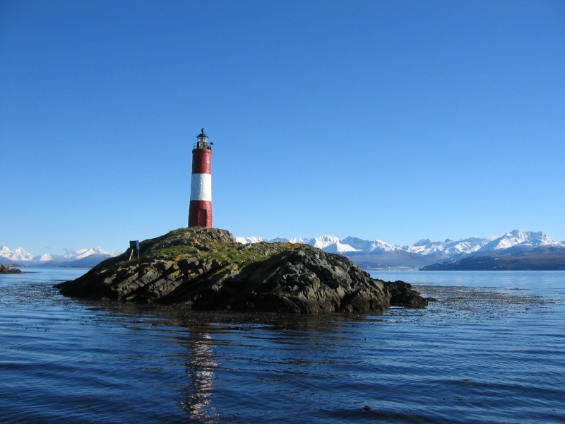
Les Eclaireurs Lighthouse, Beagle channel, Tierra del Fuego, Argentina. Paul Trilsbeek. CC BY-SA-NC
Methodology
1. Evaluate existing literature and develop a sea-level database that covers the last 500 years, starting from Rubio-Sandoval et al. (2025). This database will merge instrumental data into a harmonised temporal framework. In areas close to plate boundaries (e.g., Tierra del Fuego), this will employ approaches to account for active tectonics that imply non-linear vertical land motion (e.g., Klos et al. 2019).
2. Run models of glacial isostatic adjustment and associated sea-level change in response to the deglaciation of the Patagonian Ice Sheet using state-of-the-art ice sheet data (Davies et al. 2020) and reconstructions, and experiment with earth properties (e.g. Bartholet et al. 2020) and timing of ice-mass changes.
3. Validate model results against sea-level data and GNSS observations across different time periods (e.g. late Pleistocene, mid-Holocene, last-500 years) and develop spatio-temporal localised corrections for sea-level observations.
4. Calculate a new, contemporary local sea-level budget (Dangendorf et al. 2024) in study location using results from GIA modelling study.
5. Calculate new local sea-level projections (e.g., Jackson et al. 2016) in study-location using results from GIA modelling study.
Project Timeline
Year 1
Induction process
Training in data-handling, sea-level databases, and GIA modelling from supervisory team.
Conduct literature review
Compile instrumental datasets (tide gauges and GNSS) and construct database for last 500 years.
Submit year 1 progress report
Year 2
Run models of glacial isostatic adjustment following deglaciation of the Patagonian Ice Sheet using a suite of input parameters (earth structure and state-of-the-art Patagonian ice sheet model) to obtain a suite of sea-level predictions.
Test a range of deformation models (1D vs 3D), adjustments to ice model using databases as means of validation over different time periods (e.g., late Pleistocene, mid-Holocene, last-500 years)
Attend and present at GIA Workshop – Dresden (Germany)
Draft paper for journal
Submit year 2 progress report
Year 3
Deliver year 3 progress update presentation
Recalculate local sea-level budget using modelling results and compare with published budgets to identify differences.
Construct new local sea-level projections using results and study implications for wider impacts.
Draft thesis chapters and/or journal submission
Year 3.5
Finalise thesis chapters
Thesis submission
Training
& Skills
The student will receive both generic and bespoke training in GPS, sea level (tide gauges and satellite altimetry) and GIA modelling from the supervision team. This will include software training in Linux and associated scripting; Matlab, Python or R; and finite-element modelling.
Additional numerical modelling and data-manipulation skills will be provided national/international workshops with this focus (e.g., Delft Sea-Level Summer School, Netherlands 2027 or GIA Training School).
Broader transferable skills will be developed through various training events at Durham University offered by IAPETUS (e.g., communicating science, thesis writing, writing for publication, presentation skills).
References & further reading
Bartholet, A., Milne, G.A. and Latychev, K., 2020. Modelling sea-level fingerprints of glaciated regions with low mantle viscosity. Earth System Dynamics Discussions, 2020, pp.1-18.
Dangendorf, S., Sun, Q., Wahl, T., Thompson, P., Mitrovica, J.X. and Hamlington, B., 2024. Probabilistic reconstruction of sea-level changes and their causes since 1900. Earth System Science Data Discussions, 2024, pp.1-37.
Davies, B. J., Darvill, C., Lovell, H., Bendle, J., Dowdeswell, J., Fabel, D., et al. (2020). The evolution of the Patagonian Ice Sheet from 35 ka to the present day (PATICE). Earth-Science Reviews, 204, 103152. https://www.sciencedirect.com/science/article/pii/S0012825219306233
Jackson, L.P. and Jevrejeva, S., 2016. A probabilistic approach to 21st century regional sea-level projections using RCP and High-end scenarios. Global and Planetary Change, 146, pp.179-189.
Klos, A., Kusche, J., Fenoglio-Marc, L., Bos, M.S. and Bogusz, J., 2019. Introducing a vertical land motion model for improving estimates of sea level rates derived from tide gauge records affected by earthquakes. GPS Solutions, 23(4), p.102.
Rubio-Sandoval, K., Shaw, T., Vacchi, M., Khan, N., Horton, B., Angulo, R., Pappalardo, M., Ferreira, A., Richiano, S., De Souza, M. and Fonseca Giannini, P., 2025. Holocene relative sea-level changes from the Atlantic coast of South America. EarthArXiv eprints, p.X5KB2W.
Zemp, M., Huss, M., Thibert, E., Eckert, N., McNabb, R., Huber, J., Barandun, M., Machguth, H., Nussbaumer, S.U., Gärtner-Roer, I., 2019. Global glacier mass changes and their contributions to sea-level rise from 1961 to 2016. Nature 568, 382–386.