IAP-25-110
Environmental drivers in archaeology: past, present and future under the lens of geophysics
The aim of this PhD is to use geophysical tools to investigate channelling and fluctuations of groundwater in the context of archaeological and palaeoenvironmental features and deposits. The objectives are (1) to provide high-resolution tomographic imaging of features and deposits (2) to refocus and refine methodologies for intensive geophysical investigation of potentially waterlogged archaeology (3) to assist and inform future conservation initiatives or targeted excavations.
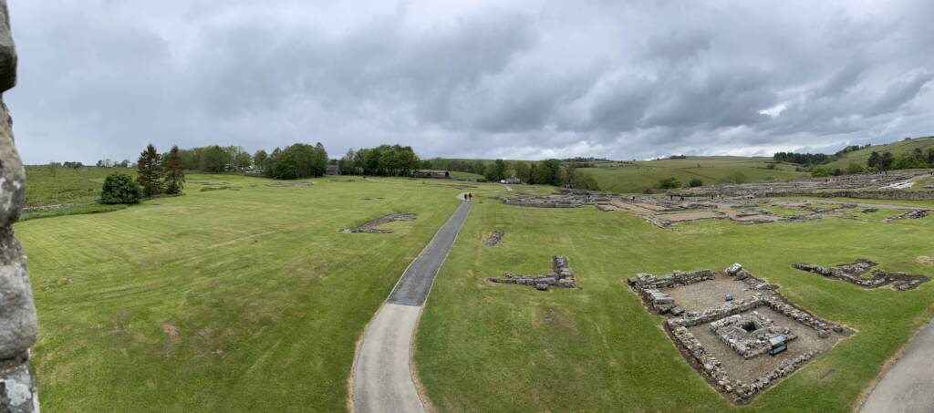
The North East of England is particularly rich in Roman frontier archaeology (e.g. Hadrian’s Wall, Dere Street, Corbridge) spanning several centuries, as well as prehistoric, Medieval and industrial heritage. Many scheduled and unscheduled sites have the potential to preserve nationally significant deposits, containing preserved palaeoenvironmental and artefactual remains. However, intensive geophysical investigation of such sites is often constrained by lack of institutional funding, or lack of capacity to assist with and facilitate research-based geophysics. This PhD proposes to combine funding, expertise and two Roman sites in the care of the Vindolanda Trust: Roman Vindolanda( https://www.vindolanda.com/ ) and Magna (https://romanarmymuseum.com/).
Both sites are Roman Forts and part of the UNESCO Frontiers of the Roman Empire World Heritage Site. Both have revealed evidence of anaerobic environments, where very limited oxygen is present. Such environments are most common in deposits which lie beneath a stable water table, and preserve key organic artifacts such as leather shoes, textiles, wooden tools and inscribed tablets. Pollen, plant matter and insect remains are also better preserved in such conditions, allowing palynological studies to reconstruct past environments, trace vegetation changes over time or assist in biostratigraphy.
Due to changing climate patterns and extreme weather events Vindolanda and Magna, as well as Hadrian’s Wall and the whole of Northumberland, are seeing increasingly fluctuating groundwater tables. These groundwater changes can cause severe problems for buried archaeological remains, – changes in PH and ORP (oxidation-reduction potential) affect the degradation of wood, textiles and leather artefacts. The fluctuating groundwater and associated chemical changes between aerobic and anaerobic environments have a significant impact upon preservation
36 sites and monuments are already classified by Historic England as at risk due to drainage/dewatering (https://historicengland.org.uk/listing/heritage-at-risk/). Many more will not yet have been identified as at risk despite worsening weather patterns (concentrated waterfall followed by draught periods) which will accelerate the loss.
This PhD focuses on monitoring anaerobic preservation or waterlogged remains in significant fort ditches at both Vindolanda and Magna. Many fort ditches became the main rubbish repositories for Roman occupied sites, holding a wealth of material about the former use and occupation by military communities who live in the region more than 1600 years ago.
Click on an image to expand
Image Captions
Roman archaeology close to Hadrian’s Wall, NE of England, Vindolanda Trust
Methodology
One main current of contemporary archaeological geophysics is to deliver extensive surveys: improve on the speed and extent of data acquisition to map large domains and reveal an extended context. In this project instead, we propose to develop a different methodological approach which looks at intensive exploration: focussing on smaller structures with a larger depth-penetration to produce a far more detailed picture of both the archaeological deposits and environmental changes taking place to them. This will assist site managers and archaeologists to consider better informed conservation approaches to targeted structures of archaeological interest, to study deeper-rooted human made structures, examine how they interact with the contextual geology, groundwater and soil and investigate the palaeo-environment in which they were built.
During this project, Time-lapse, high resolution 3D geophysical surveys will map the changes in water content over time using Electrical Resistivity Tomography (ERT), Ground Penetrating Radar (GPR) and Electro-Magnetic Induction (EM). Advanced geophysical inversion methods will be used to produce tomographic sections and 3D volumes interpreted as ground and soil layering, archaeological deposits and buried structures.
Changes in resistivity contrasts over time will be used to reveal preferential water-channelling structures, either natural (palaeochannels) or man-made (e.g. infilled pits and ditches or building foundations). The water table fluctuation pattern over a 2 year period, including seasonal variations, droughts and punctual events such as storms, will be monitored and compared to site sampling sites equipped with piezometric water-level sensors . The fluctuation pattern will then be extrapolated using probability forecasting of extreme events to predict if the target organic area is or will be at risk in the near future.
The candidate will have the opportunity to conduct fieldwork at both sites managed by the Vindolanda Trust at different times through the year and will be supported by both the Vindolanda Trust archaeological senior team, and by the Trust’s strong volunteer community. Key support staff for the project from the Vindolanda Trust will be Dr. Gillian Taylor (Trustee and Associate Professor at Teesside Univeristy), Dr. Andrew Birley (CEO and Director of Excavations) and Dr. Marta Alberti-Dunn (Deputy Director of Excavations).
The Trust is committed to host the successful candidate in its on-site Hedley Centre accommodation for one month of each year of the candidacy, during the months of October to March, for a total of 3 months of on-site placement. Furthermore, the Trust is committed to support the successful candidate’s equipment, travel and research costs up to £1000.
Project Timeline
Year 1
In the first year, the student will conduce bibliographic research, meet regularly with stakeholders to learn about the environment and the historical context of the target sites, familiarise themselves with the geophysical tools and methods and conduct pilot surveys to inform the design of advanced and high-resolution surveys at both Vindolanda and Magna Roman forts. The student will also develop data interpretation skills, from current groundwater monitoring sensors.
Year 2
In the second year, the student will primarily focus on the fieldwork, working with archaeologists specialists of the target sites and gather a 4D (3D plus time) high-resolution data grid. As part of their placement with the CASE partner the student will be involved in active conservation initiatives directly related to their research on the groundworks and structures.
Year 3
Advanced inversion techniques will be used on the data grids to obtain sections and volumes of resistivity and susceptibility parameters that will be interpreted, under the supervision of trained archaeologists, to reveal the archaeological structures and deposits, and groundwater flow patterns.
Year 3.5
In the final months, priority will be given to finalising of the writing and dissemination of the results, meeting with stakeholders and drawing with them the guidelines for conservation initiatives. In addition to the scientific and archaeological dissemination of the results through publications, the results from the survey will be curated into a series of outreach supports for the public, to be displayed in museums or at archaeological sites. These can include videos, images and 3D printed models representing the structure of the groundworks at the small scale.
Training
& Skills
The successful candidate will acquire or improve the following skills, through a comprehensive training programme:
– Computer-assisted geophysical methods and coding. Introduction to forward modelling techniques, inverse theory and advanced geophysical tomography imaging software (e.g. PyGimli, https://www.pygimli.org/)
– Use of advanced geophysical survey equipment, fieldwork practice, logistics and planning, permits and good practice in relations with landowners, government regulation authorities and general publicIntroduction to the theory, method and practice of the conservation and monitoring of archaeological sites and monuments.
– Statistical analysis of datasets
– Public engagement and outreach, transposing complex scientific results into accessible modelling for both heritage visitors and the wider community
– Working with a team of dedicated volunteers to support the work and also, vitally, pass on their own skills and experience within the wider Hadrian’s Wall community.
References & further reading
Jones, L., Jenkins, J., Foltier, L., & Nielsen, S. (2024). Electrical resistivity tomography of a masonry bridge: assessing water infiltration on Prebends Bridge, Durham, UK. Journal of Architectural Conservation, 30(2–3), 149–168. https://doi.org/10.1080/13556207.2024.2357501
Taylor, G., Birley, B., Birley, A. & Greene, E. M. (2025). Characterising the degradation of leather through the decades: Evidence from 50 years of excavations at Vindolanda Roman fort. Wet Organic Archaeological Materials 2025: Proceedings of the 16th Conference of the ICOM-CC Wet Organic Archaeological Materials Working Group, Göteborg, 2025. ICOM-CC, 9 p.
Marta Alberti-Dunn (2025). The Castrum Project: The 2024 Vindolanda Excavations – Vindolanda Archaeology reports – Castrum
ISBN-13 : 978-1068408403.
Birley A. 2016. ‘The complexity of intramural and extramural relationships on the northern frontier of Roman Britain – a Vindolanda case study’ In Small Finds & Ancient Social Practices in the Northwest Provinces of the Roman Empire. Hoss & Whitmore eds. Oxbow Books. Oxford. 146-173