IAP-25-112
Assessing Magmatic Dead Carbon Effects on Radiocarbon Dates: A Multi-Method Investigation of Volcanic CO₂ Degassing at Laacher See, Germany
The Laacher See eruption (LSE) approximately 13,000 years ago produced widespread tephra deposits across Europe, making the Laacher See tephra (LST) a crucial chronostratigraphic marker for Late Pleistocene sequences. However, recent high-precision radiocarbon dating has generated controversy. Reinig et al. (2021) dated the eruption to 13,006 ± 9 calibrated years BP using radiocarbon measurements from subfossil trees killed by pyroclastic deposits, approximately 130 years older than previous estimates from varve-counting (12,880 ± 40 years BP) and ⁴⁰Ar/³⁹Ar dating (12,900 ± 560 years BP).
Baldini et al. (2023) suggested that this age discrepancy might result from incorporation of radiocarbon-free magmatic CO₂ into the trees during photosynthesis, a phenomenon documented at other volcanically active sites. The Laacher See volcano remains in a quiescent phase with visible magmatic gas release, including active CO₂ degassing from fumaroles and diffuse soil emissions. Studies elsewhere demonstrate that magmatic CO₂ incorporation can make radiocarbon ages appear 50-200 years too old, with effects varying spatially and temporally depending on local CO₂ flux dynamics.
This project will test whether magmatic CO₂ affected the Reinig et al. (2021) age determination by comprehensively mapping modern CO₂ emissions around Laacher See and measuring their impact on radiocarbon content in living trees. The implications are significant: an incorrect LSE date would affect interpretation of regional climate records, misalign paleoenvironmental sequences across Europe, and potentially exclude the LSE from consideration as a driver of abrupt Late Glacial climate change (e.g., the Younger Dryas Event). The project will also have implications for the use of radiocarbon dating in volcanic regions more generally.
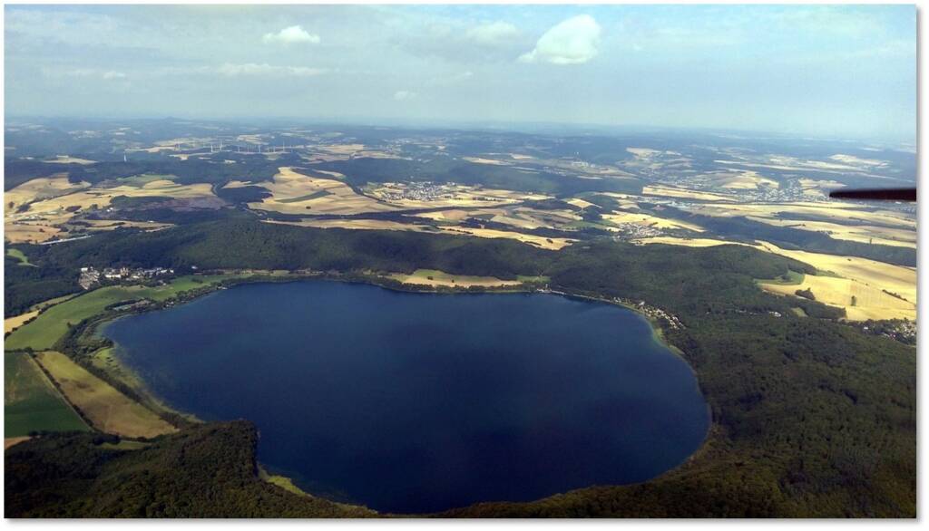
Click on an image to expand
Image Captions
Df1paw, CC BY-SA 4.0, https://commons.wikimedia.org/w/index.php?curid=61161484.
Methodology
The project employs an integrated field, analytical, and modelling approach to reconstruct CO₂ degassing patterns and their effects on tree radiocarbon signatures. The methodology maximises data collection efficiency and incorporates emerging technologies and analytical approaches, including exciting remote sensing aspects.
Phase 0: Preliminary Assessment and Rapid Zone Identification (Months 1-3)
To accelerate identification of high-flux zones and enable earlier installation of long-term monitoring equipment, the project will begin with a rapid assessment combining multiple approaches:
• Literature and data synthesis: Compile and analyse existing CO₂ monitoring datasets from Laacher See (collected by collaborators at Ghent University and other research groups) to identify known degassing zones
• Remote sensing analysis: Use satellite thermal imagery and vegetation indices to identify potential high-flux zones based on vegetation stress patterns and thermal anomalies
• Preliminary field reconnaissance: Conduct rapid transects across the caldera using portable CO₂ probes to quickly characterize the spatial distribution of degassing and prioritize areas for detailed mapping
• Early monitor installation: Based on this preliminary assessment, install Vaisala soil air CO₂ loggers at identified high-flux and low-flux (control) sites by Month 3 to maximize temporal data collection
This approach will enable continuous CO₂ monitoring to begin early in the project, capturing at least 2.5 years of temporal data.
Phase 1: Detailed Spatial CO₂ Mapping (Months 3-12)
Building on the preliminary assessment, systematic high-resolution CO₂ measurements will be conducted across the Laacher See caldera using portable Vaisala CO₂ probes. Measurements will be taken at standardized heights (10 cm underground; 10 cm and 100 cm above ground) along transects across the site, with particular focus on areas near the Reinig et al. (2021) sampling locations.
Seasonal coverage: To capture seasonal variability in degassing patterns, some transects will be conducted twice, in contrasting seasons (summer and winter). This will help determine whether seasonal changes in temperature, precipitation, and soil moisture affect CO₂ flux patterns and their potential influence on tree radiocarbon signatures.
Data products: These data will be used to create high-resolution contour maps of CO₂ concentrations, identifying spatial patterns of magmatic CO₂ emissions and quantifying zones of potential tree exposure.
Phase 2: Modern Tree Radiocarbon Analysis (Months 6-20)
Tree cores will be extracted from living trees using increment borers, with the following sampling strategy:
• High-flux zones: 3 trees per identified high-flux zone (at least 2 zones = minimum 6 trees total)
• Moderate-flux zones: 2-3 trees from transitional areas showing intermediate CO₂ levels
• Low-flux zones (control): 2-3 trees from areas with background atmospheric CO₂ only
This sampling design will provide a gradient of CO₂ exposure and enable quantitative relationships to be established between CO₂ flux and radiocarbon age bias.
Annual rings from recent years (2000-2025) will be analysed for ¹⁴C content at the NERC Radiocarbon Facility (East Kilbride). Results will be compared with atmospheric ¹⁴C records (IntCal20) to quantify magmatic CO₂ incorporation. If magmatic influence is absent, tree ¹⁴C should match atmospheric values; deviations will indicate magmatic CO₂ uptake and allow calculation of the resulting radiocarbon age bias.
Phase 3: Regional CO₂ Survey (Months 12-24)
The student will extend CO₂ mapping to the specific locations where subfossil trees used to produce the radiocarbon age for the ~13,000-year Laacher See eruption were sampled, several kilometres from the caldera centre. These secondary surveys will determine whether magmatic CO₂ emissions could have reached areas that contained the ~13,000-year-old trees, providing direct context for evaluating potential age biases in the original radiocarbon dates.
Integration with existing monitoring: This phase will build upon and complement existing CO₂ monitoring networks in the Laacher See area. Data will be integrated with historical measurements to establish longer-term trends and spatial patterns.
Phase 4: Temporal CO₂ Monitoring (Months 1-42)
This follows closely on from the Phase 0 installation, but may reassess the location of the loggers pending the results of Phases 1-3:
• High-flux monitoring: Vaisala soil air CO₂ loggers installed at 2-3 high-flux sites to record continuous CO₂ concentrations
• Control monitoring: At least one logger installed in a low-flux zone to provide baseline comparison and quantify background variability
• Duration: Monitoring will extend for the full project duration (3.5 years), providing robust temporal datasets
Time-series analysis will identify temporal patterns and correlate CO₂ flux with potential drivers including:
• Meteorological variables (temperature, atmospheric pressure, precipitation, soil moisture)
• Seismic activity (if available from regional networks)
• Seasonal cycles
• Earth tidal effects
This phase also presents the opportunity to explore machine learning approaches to model degassing dynamics in relation to environmental factors.
Phase 5: Remote Sensing Integration (Months 12-36)
To contextualize field measurements within regional CO₂ flux patterns, the project will explore integration with the new MicroCarb CO₂ monitoring satellite launched by ESA/CNES in 2025. Although the spatial resolution (~2 km x 2km) is too coarse for site-scale flux mapping, MicroCarb data could:
• Provide regional CO₂ flux trends and seasonal patterns
• Identify larger-scale atmospheric CO₂ anomalies associated with the volcanic system compared with surrounding non-volcanic regions
• Validate upscaling of ground-based measurements
• Detect potential changes in regional degassing patterns during the monitoring period
• Could potentially be used to look at other volcanically active regions
This will be an exploratory component that adds value without being critical to core objectives.
Phase 6: Synthesis and Modelling (Months 24-42)
Spatial and temporal CO₂ data will be integrated with tree ¹⁴C measurements to model the magnitude of potential radiocarbon age bias at the Reinig et al. subfossil tree sampling locations.
Analytical approaches may include:
• Statistical analysis to quantify relationships between CO₂ flux and radiocarbon bias
• Machine learning models to predict spatial and temporal patterns of CO₂-induced age bias
• Monte Carlo simulations to assess uncertainty in age corrections
• Geospatial modelling (GIS-based interpolation) to create predictive maps of radiocarbon bias risk
The student will evaluate whether observed modern CO₂ fluxes could account for the ~130-year age offset and explore implications for radiocarbon dating of other volcanic events where magmatic CO₂ may have influenced results.
Project Timeline
Year 1
• Conduct comprehensive literature review on volcanic CO₂ degassing (particularly at the Laacher See site) and radiocarbon dating biases
• Complete Phase 0 rapid assessment and early monitor installation (Months 1-3)
• Begin Phase 4 continuous CO₂ monitoring from Month 3 onward
• Complete Phase 1 detailed CO₂ spatial mapping including seasonal transect
• Collect and archive tree cores for radiocarbon analysis
• Attend IAPETUS training events and present preliminary results at Durham Earth Sciences seminar
Year 2
• Complete tree core sampling across flux gradient (high, moderate, low flux zones)
• Process and submit samples for radiocarbon measurements at NERC facility
• Continue Phase 3 CO₂ spatial mapping at Reinig et al. tree sampling locations
• Analyse temporal CO₂ patterns and meteorological correlations
• Begin exploring machine learning approaches for CO₂ flux modelling
• Prepare first manuscript on spatial CO₂ distribution patterns and seasonal variability
• Present findings at national conference (e.g., Volcanic and Magmatic Studies Group)
• Visit Basel, and Ghent for collaborative data analysis discussions
Year 3
• Complete all field measurements and laboratory analyses
• Develop integrated CO₂-radiocarbon bias model using statistical and machine learning approaches
• Integrate MicroCarb satellite data to contextualize regional patterns
• Prepare second manuscript on tree radiocarbon results and flux-bias relationships
• Present at international conference (e.g., EGU or Goldschmidt)
• Synthesize results to evaluate the Reinig et al. (2021) age determination
Year 3.5
• Finalize third manuscript on temporal CO₂ variability, environmental controls, and implications for volcanic chronology
• Complete thesis incorporating all three manuscripts plus synthesis chapter
• Submit and defend PhD thesis
Training
& Skills
This project offers comprehensive training in field volcanology, geochemical analysis, radiocarbon dating, and palaeoclimate reconstruction. The student will gain expertise in:
Field skills:
• Portable gas measurement systems and sensor deployment
• Increment core sampling techniques
• GPS and GIS field data collection
• Multi-seasonal fieldwork in volcanic environments
Laboratory skills:
• Clean laboratory procedures for radiocarbon sample preparation at Durham
• Sample processing at the NERC Radiocarbon Facility
• Quality control and data validation protocols
Analytical and computational skills:
• GIS-based spatial analysis and interpolation methods
• Time-series analysis and spectral analysis techniques
• Statistical modeling (regression, mixed-effects models)
• Machine learning approaches (random forest, neural networks, advanced nested loop analysis)
• Programming in R, Python, and/or Matlab
• Remote sensing data processing and interpretation
Professional skills:
• Scientific writing and manuscript preparation
• Data visualization and presentation
• Conference presentations
• Collaborative research across international teams
• Project management and fieldwork logistics
It is envisaged that the student travel to St Andrews from Durham multiple times to discuss the project with the collaborators there, particularly the geochemical and tree ring parts of the research. International collaborations provide opportunities for research visits to Basel, Ghent, and possibly Munich. The student will join Durham’s active Environmental Research Group and Volcanology Group, and benefit from interactions with the broader IAPETUS cohort through residential training courses and annual conferences.
This interdisciplinary project bridges volcanology, atmospheric science, palaeoclimatology, and Quaternary geochronology, developing a skillset highly valued in academic research, geological surveys, environmental consulting, and climate science. The student will gain experience addressing high-profile scientific controversies through systematic field investigation and innovative analytical approaches, with results likely to have immediate impact on Late Glacial European chronostratigraphy.
References & further reading
Baldini, J.U.L., Brown, R.J., Wadsworth, F.B., Paine, A.R., Campbell, J.W., Green, C.E., Mawdsley, N. & Baldini, L.M. (2023). Possible magmatic CO₂ influence on the Laacher See eruption date. Nature, 619, E1-E2.
Reinig, F., Wacker, L., Jöris, O., Oppenheimer, C., Guidobaldi, G., Nievergelt, D., Adolphi, F., Cherubini, P., Engels, S., Esper, J., Land, A., Lane, C., Pfanz, H., Remmele, S., Sigl, M., Sookdeo, A. & Büntgen, U. (2021). Precise date for the Laacher See eruption synchronizes the Younger Dryas. Nature, 595, 66-69.
Pasquier-Cardin, A., Allard, P., Ferreira, T., Hatte, C., Coutinho, R., Fontugne, M. & Jaudon, M. (1999). Magma-derived CO₂ emissions recorded in ¹⁴C and ¹³C content of plants growing in Furnas caldera, Azores. Journal of Volcanology and Geothermal Research, 92, 195-207.
Cook, A.C., Hainsworth, L.J., Sorey, M.L., Evans, W.C. & Southon, J.R. (2001). Radiocarbon studies of plant leaves and tree rings from Mammoth Mountain, CA: a long-term record of magmatic CO₂ release. Chemical Geology, 177, 117-131.
Albers, S., Verwimp, A., Caudron, C., Hermans, T., Versteeg, W., Jouve, G. & De Batist, M. (2021). Geophysical evidence of gas seepage and mass movement in the Laacher See volcanic lake, western Germany. EGU General Assembly.
Brauer, A., Endres, C., Günter, C., Litt, T., Stebich, M. & Negendank, J.F.W. (1999). High resolution sediment and vegetation responses to Younger Dryas climate change in varved lake sediments from Meerfelder Maar, Germany. Quaternary Science Reviews, 18, 321-329.