IAP-25-087
What controls ice flow across Palmer and Ellsworth Lands, Antarctica?
The Antarctic Ice Sheet contains enough freshwater to raise global sea level by 58 metres and is losing mass at an accelerating rate. More than 90% of the ice mass lost to the oceans from Antarctica comes from fast-flowing ice streams – highly dynamic corridors of ice that are separated by slower-flowing areas of the ice sheet. An understanding of how ice streams changed their flow directions and velocities in the past is needed to derive robust projections of future ice-stream behaviour and, thus, global sea-level rise.
Present-day ice flow in Palmer and Ellsworth Lands is a patchwork of varied ice dynamics, varying from the narrow topographically constrained glaciers of the Antarctic Peninsula to wide fast-flowing ice streams flowing from West Antarctica (e.g. Evans, Rutford ice streams). Satellite observations demonstrate ice surface thinning, speed-up and grounding-line retreat in this region (Wouters et al., 2015). Despite this, little is known about the controls on ice flow, nor how the pattern and rate of ice flow is changing over time.
Over millennial timescales, evidence exists for flow-switching and water piracy between Rutford Ice Stream and Carlson Inlet (Vaughan et al, 2008; King et al., 2011). However, the timing of glaciological change, and the processes driving it, are poorly understood or constrained.
All glaciers in Palmer and Ellsworth Lands are potentially vulnerable to future dynamic change driven by climate warming, resulting in: (i) ice-stream flow-switching; (ii) ice surface elevation change; and (iii) rapid and unstable retreat of the grounded ice margin. Each of these processes has implications for the flux of grounded ice into the ocean.
To address these knowledge gaps, this PhD project will integrate satellite remote sensing, airborne and ground-based geophysical datasets to evaluate how factors such as topography (Carter et al., 2025) and basal hydrology control the pattern and discharge of ice flow at the boundary between West Antarctica and the Antarctic Peninsula. We will use these data to characterise present-day ice flow, investigate how ice flow has changed in the past, and evaluate how ice flow could change in the future.
The key research questions, all critical for understanding ongoing change in the West Antarctic Ice Sheet, are:
1. What is the present-day ice flow in Palmer and Ellsworth Lands? How should the fast-flowing elements be categorised, e.g. as ice streams, outlet glaciers, etc.? What insights into modern-day glaciological processes, and their controls, can this reveal?
2. What was the nature of past ice flow in Palmer and Ellsworth Lands? Where were fast-flowing corridors of ice located in the past, and did this region experience ice-stream flow-switching?
3. What changes in ice-flow dynamics and glaciological structures in the satellite observational era (e.g. crevassing, locations of shear margins) are revealed by existing, as well as new and innovative, satellite and geophysical datasets?
This project and its goals align closely with multiple ongoing international scientific efforts (e.g. the Scientific Committee for Antarctic Research RINGS ice sheet margin action group). This presents opportunities for networking, wider scientific collaboration, and potentially for fieldwork.

Click on an image to expand
Image Captions
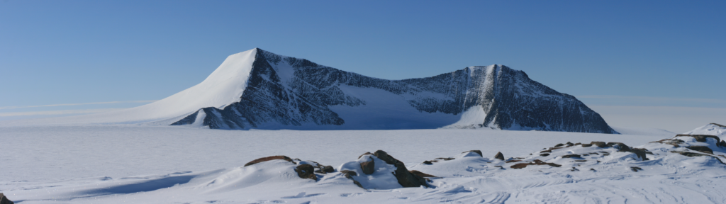
Figure 1: 3D visualisation of ice flow in Ellsworth and Palmer Lands, Antarctica. Major ice streams and outlet glaciers are indicated.,Figure 2: The landscape in Ellsworth Land. Photograph taken by Neil Ross whilst acquiring the INCISED ground-based ice-penetrating radar data that will be used in this PhD project.
Methodology
The project will utilise and integrate existing freely-available satellite and airborne geophysical datasets, including:
• Airborne ice-penetrating radar acquired by the British Antarctic Survey (BAS) and NASA’s Operation IceBridge. These will be analysed to: (i) provide the glaciological/geomorphic setting of the region; (ii) test hypotheses of past ice-flow changes; and (iii) characterise near-surface englacial features (e.g. crevasses, layering etc)
• Satellite products of the ice surface (e.g. ESA’s Sentinel-1 and -2) will be integrated with Digital Elevation Models to: (i) classify the glaciers and ice streams of Palmer and Ellsworth Lands; (ii) identify localities where past ice-flow changes may have occurred; and (iii) reveal very recent changes in glaciological processes.
• High-resolution (0.5-1 km line spacing) ground-based ice-penetrating radar data acquired through the Durham University-led INCISED project will be used to calibrate the surface and near-surface signatures of ice flow and sub-ice features observed in satellite imagery, for both existing (e.g. RADARSAT) and novel datasets (e.g. Biomass, NISAR etc.)
Project Timeline
Year 1
Systematic synoptic ‘mapping’ and physical characterisation of features diagnostic of controls on ice flow (e.g. shear margins, flow stripes and zones of crevassing) across the study region. Present-day ice flow and dynamics will be compared to knowledge of past ice flow.
Year 2
Comparison between and/or integration of new and novel satellite remote sensing datasets (e.g. NISAR/Biomass), the glaciological product from year 1, and airborne and ground-based geophysical datasets (e.g. INCISED radar data). Exploration of the new satellite datasets will be undertaken, with the goal of revealing the innovative potential that satellites like Biomass provide. 1-2 week visit BAS in Cambridge to work with Dr Jordan.
Year 3
Year 3 is deliberately left open to enable the research student to choose the avenue they wish to explore during the latter parts of their PhD. It will be dedicated to a specific targeted area or process within the study region that has been identified as important during year 2. 1-2 week visit BAS in Cambridge to work with Dr Jordan.
Year 3.5
Write-up and submit PhD thesis.
Training
& Skills
There will be opportunities for the successful candidate to develop skills and to undergo training throughout the course of the PhD. This training can be ‘in-house’ at Newcastle University, as well as via external training (e.g. NERC-funded training courses for PhD researchers, or overseas glaciological summer schools). There will be opportunities for developing ‘big data’ skills, i.e. remote sensing, coding, geophysics and numerical modelling, highly sought after in both academia and industry. The supervisory team have substantial experience in supporting their PhD researchers to undertake training additional to PhD projects (e.g. IAPETUS industrial placements, UKRI overseas placements, civil service placements etc.). We will happily support any future PhD researchers to also explore such opportunities.
References & further reading
Carter et al., (2024) Extensive palaeo-surfaces benea[th the Evans–Rutford region of the West Antarctic Ice Sheet control modern and past ice flow [https://doi.org/10.5194/tc-18-2277-2024] Jezek et al., (1993) Analysis of synthetic aperture radar Data collected over the southwestern Greenland ice sheet [https://doi.org/10.3189/S002214300001577X] King, E., (2011). Ice stream or not? Radio-echo sounding of Carlson Inlet, West Antarctica [https://doi.org/10.5194/tc-5-907-2011] Rignot et al., (2011) Ice Flow of the Antarctic Ice Sheet [https://doi.org/10.1126/science.1208336] Selley et al., (2025) Speed-up, slowdown, and redirection of ice flow on neighbouring ice streams in the Pope, Smith, and Kohler region of West Antarctica [https://doi.org/10.5194/tc-19-1725-2025] Vaughan et al., (2008). Flow-switching and water piracy between Rutford Ice Stream and Carlson Inlet, West Antarctica [https://doi.org/10.3189/002214308784409125] Wouters et al., (2015) Dynamic thinning of glaciers on the Southern Antarctic Peninsula [https://doi.org/10.1126/science.aaa5727]